UK to see further snow as wintry showers seen across the country
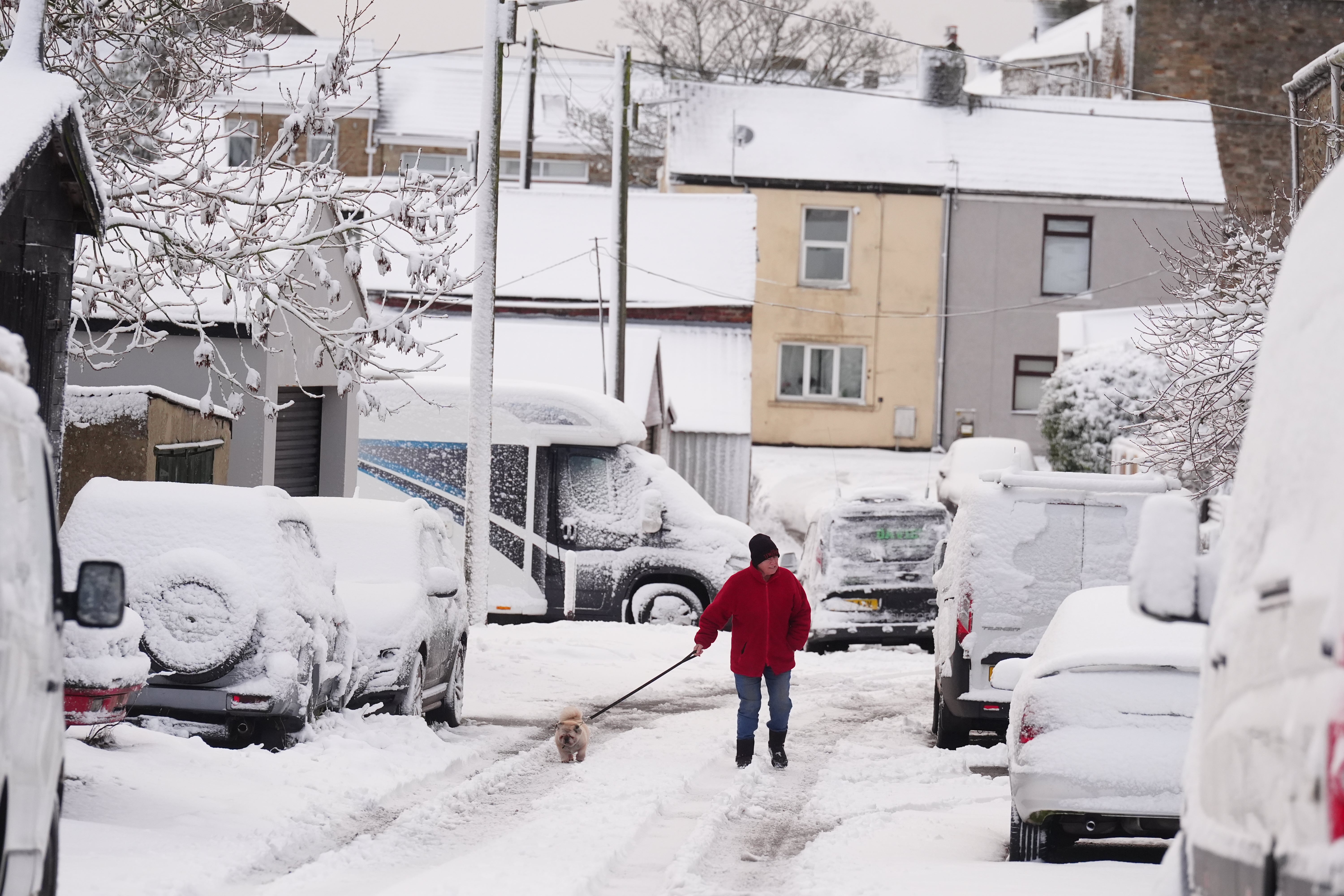
Areas including London, Hertfordshire, Berkshire, Surrey, Essex, Shropshire and Northumberland saw snow on Wednesday
Parts of the UK are set to see more snow fall on Thursday after large swathes of the country saw wintry showers leave several centimetres of snow on Wednesday.
The Met Office said snow is likely to continue to fall on on the coasts of north Scotland as well as the east and west coasts of the UK, after snow fell overnight and on Wednesday morning.
Areas including London, Hertfordshire, Berkshire, Surrey, Essex, Shropshire and Northumberland saw snow, with Met Office weather stations in Lake Vyrnwy in Powys, Wales, recording 7cm of lying snow at 8am.
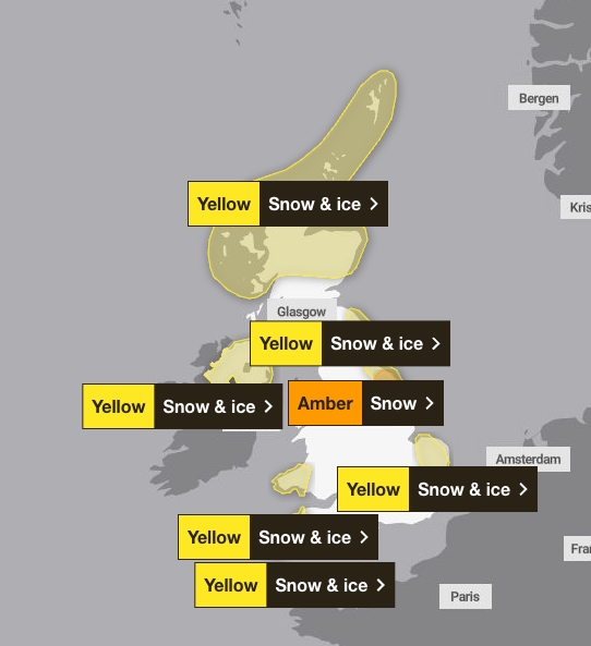
A number of warnings have been issued for snow and ice across the UK for Thursday, with the cold weather expected to continue until the weekend.
Parts of Yorkshire including York and Scarborough are subject to an amber weather warning from 5am to 9pm on Thursday, with travel delays and power cuts likely.

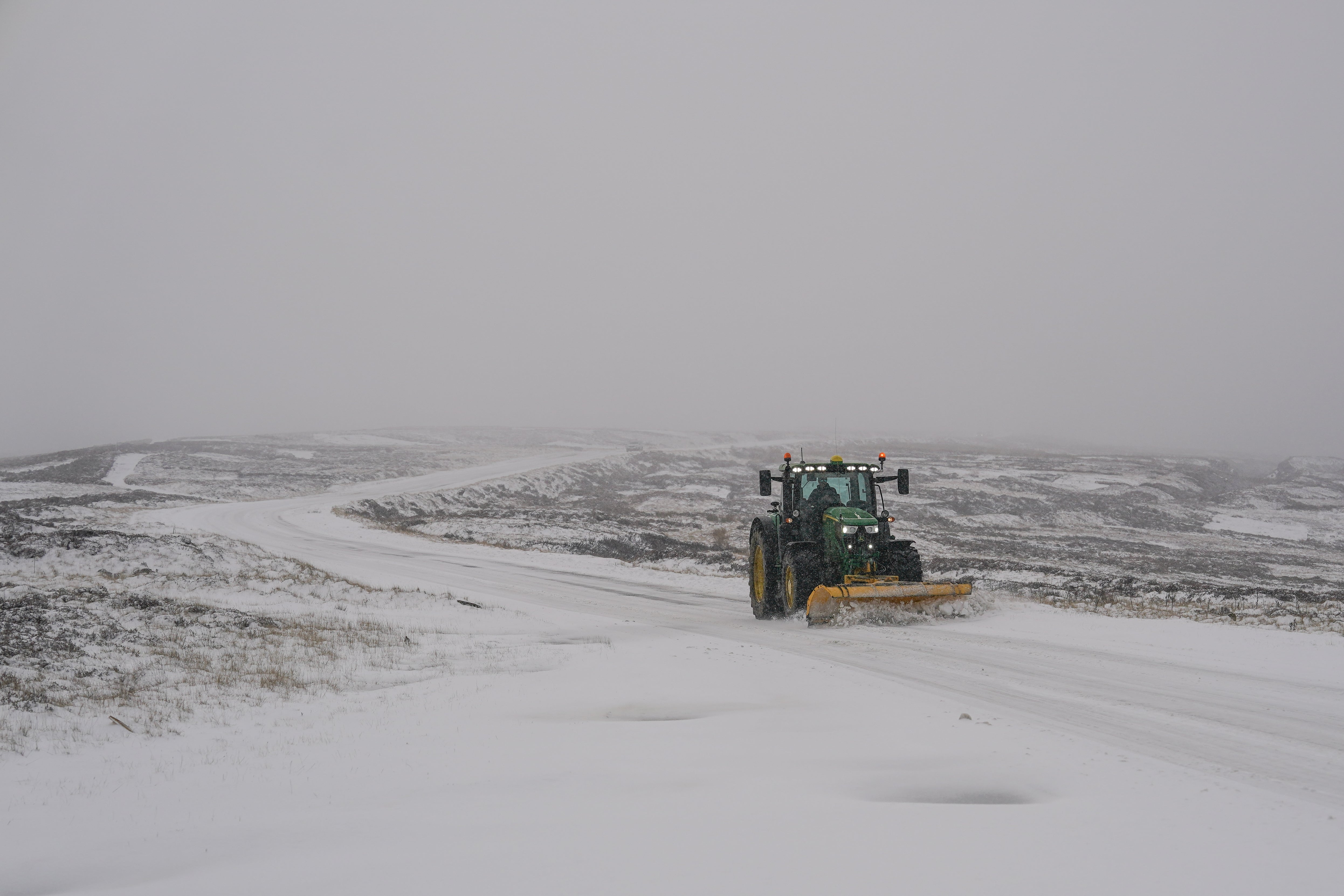
Multiple Met Office yellow warnings for ice and snow have also been issued for the coming days, covering Northern Ireland, parts of Wales, northern and south-westerly parts of England and much of Scotland.
There are six yellow warnings for snow and ice in place on Wednesday and Thursday, with the amber one for snow coming into place at 3am on Thursday.
Providing an update on the forecast, a Met Office spokesman said: “We will continue to see wintry showers on the windward coasts, so north Scotland as well as the east and west coasts of the UK.
“It’ll be brighter and drier in central inland areas. The front that has brought some falling snow in parts of the midlands and south of England this morning will clear south and then we’ll continue to see wintry showers through the day.
“A number of warnings have been issued to cover the accumulations of snow in these areas, with an amber area for a part of north east England.”
A number of weather stations reported settled snow across the country on Wednesday, including Lerwick in Shetland which saw 5cm, 4cm in Loch Glascarnoch and 7cm in Altnaharra, both in the Scottish Highlands, 2cm in Aviemore, Invernesshire, and 1cm each in Dyce, Aberdeenshire, Drumalbin in Lanarkshire and at Redesdale Camp in Northumberland.
The spokesman said while there were no records of lying snow in the south, there are areas where snow is falling but not settling and there may be areas away from the weather stations where a “dusting” of snow has settled.
Met Office chief forecaster Neil Armstrong said: “Cold Arctic air from the north is firmly in charge of the UK’s weather, bringing the first notable cold snap of this autumn and giving an early taste of winter weather.
“As a result, winter hazards are likely through the next few days, with snow and ice a particular hazard, and the coldest conditions likely on Wednesday and Thursday.
“Wintry showers will affect areas exposed to the brisk northerly wind, in particular Northern Ireland, southwest Wales, south-west England, north-east England and across the northern half of Scotland.
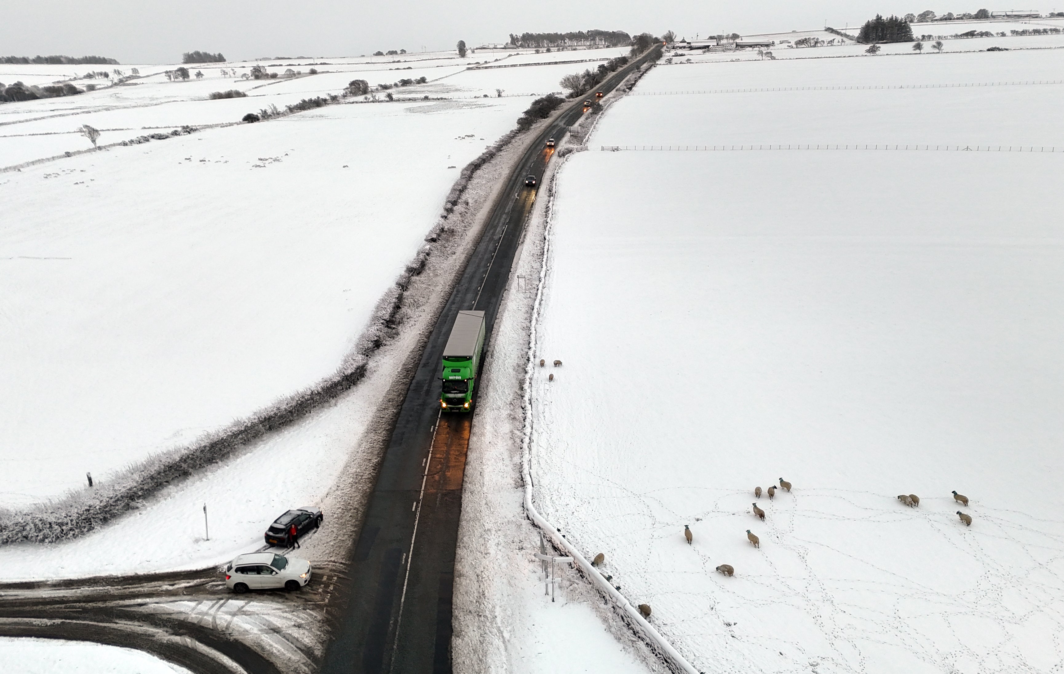
“Whilst not all places will see lying snow, where showers are most frequent accumulations of 2-5cm will be possible.
“On higher ground in Scotland, 15-20cm could accumulate, and potentially as much as 15-25cm over the North York Moors and Yorkshire Wolds.”
Join our commenting forum
Join thought-provoking conversations, follow other Independent readers and see their replies
Comments
Bookmark popover
Removed from bookmarks