Storm Isha map: Where and what time will ‘unusual’ danger-to-life wind warnings hit the UK?
Flurry of weather warnings issued due to powerful winds, with risk of tornadoes and supercell thunderstorms
The whole of the UK is subject to weather warnings as Storm Isha brings record-breaking winds and a risk of “isolated” tornadoes as it powers into Britain from across the Atlantic.
The Met Office warned about threats to life from flying debris and large waves along the coast including damage to homes and buildings, falling trees and power cuts - with weather alerts set to remain in force in some parts of the UK until midday on Wednesday.
The forecaster recorded 99mph winds at an air defence radar station operated by the Royal Air Force located at Brizlee Wood, near Alnwick in Northumberland.
Follow our live blog for all the latest weather updates
And the Tornado and Storm Research Organisation (Torro) is warning of the potential for one or two tornadoes in England and Wales today.
TORRO has said gusts could reach 80mph and there is a risk of “isolated tornadoes”.
Millions of rail, sea and air travellers are set to face disruption, with closures, cancellations and delays expected across a number of services. Some intercity train firms are already warning against travel. And in the skies, British Airways has cancelled more than three dozen flights to and from Heathrow.
The Met Office has said “everybody” will be affected by the storm, with meteorologist Tom Morgansaying: “We’re expecting widespread gales to affect the UK, amber warnings are in place for large parts of the country.
“There’s the potential for danger-to-life and damaging winds potentially leading to some power cuts in places, some large waves around coastal regions could bring some debris onto roads and trees could come down.”
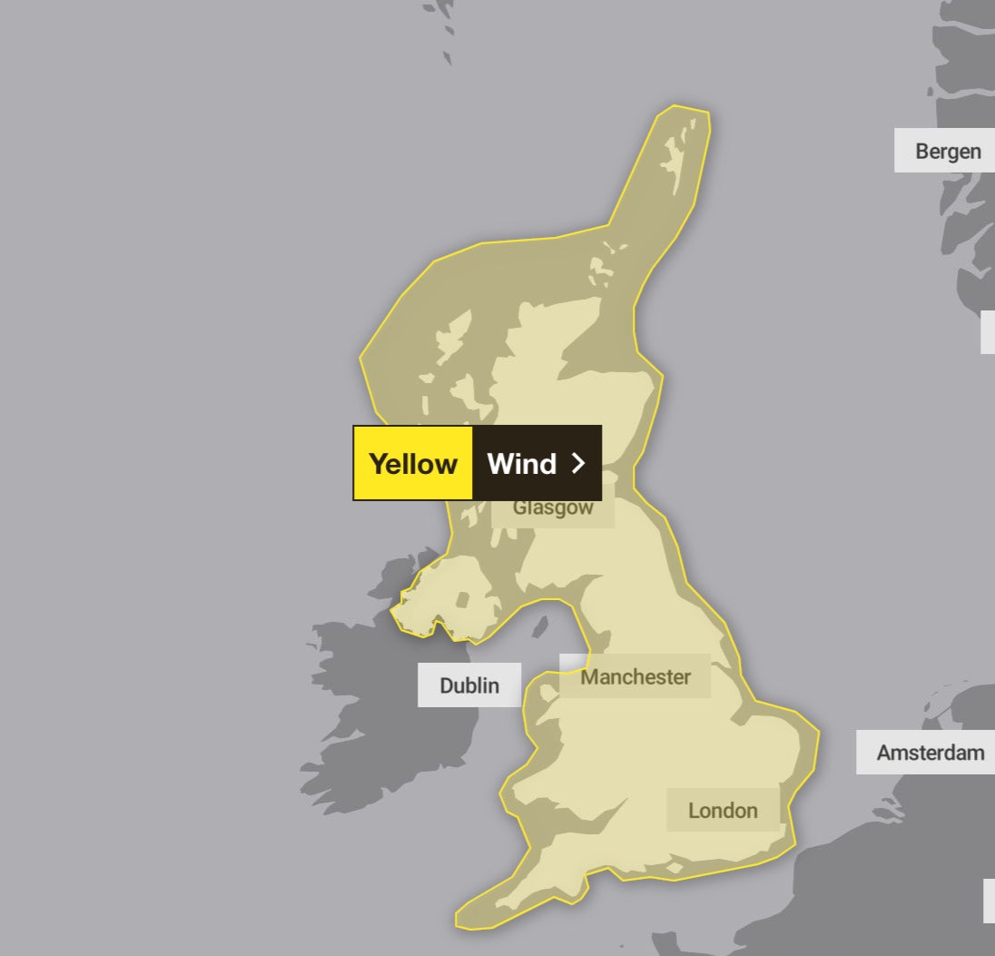
He added: “We have a wind warning in place across the whole of the UK, it’s pretty unusual for the whole of the country to be under a blanket wind warning.”
A rare red warning for wind in north-east Scotland was in place until 5am on Monday, with amber warnings covering much of the UK until 6am and further yellow warnings covering the entire country until noon.
A further yellow warning for wind for Scotland, Northern Ireland, north Wales and northern England is active from 4pm on Tuesday until noon on Wednesday.
The Met Office said “everybody” was affected by the storm.
Heavy downpours battered some places, with 26 flood warnings in place in England and 50 in Scotland.
Asked about Torro’s forecasts, the Met Office told The Independent it believes there is “there is a small chance of very isolated tornadoes, especially in the west of the UK, but also perhaps in the south”.
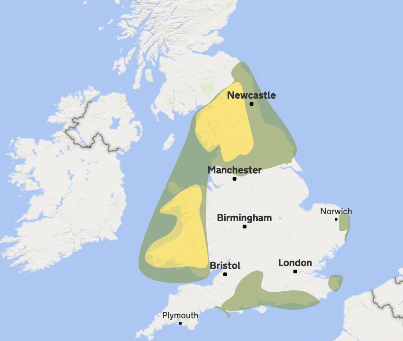
The first of these alerts – in Scotland, Northern Ireland and northern England – warns of a danger to life, with roofs being blown off and power lines brought down. The second, covering Wales and much of England, warns of power cuts, damage to buildings, and beach material being thrown onto coastal roads, sea fronts and properties.
Northern Ireland Electricity Networks said 45,000 customers were without power, while Electricity North West also said thousands of properties in north-west England had lost their supply.
Widespread power cuts in the Republic of Ireland were affecting more than 170,000 properties.
ScotRail services have been suspended since 7pm on Sunday and are not expected to resume until around noon on Monday as dozens of lines are closed due to fallen trees and flooding.
A Network Rail spokesman said: “Hundreds of engineers are already out, armed with chainsaws and cherry pickers to remove and repair.
“Once done, route-proving trains will be dispatched before passenger services can restart.
“It’s been a wild night, but passengers and railway staff have been kept safe and we will work tirelessly to get the railway back on its feet as quickly as we can.”
Lines in England and Wales have been cleared and “a good service is expected in most areas” on Monday, he added.
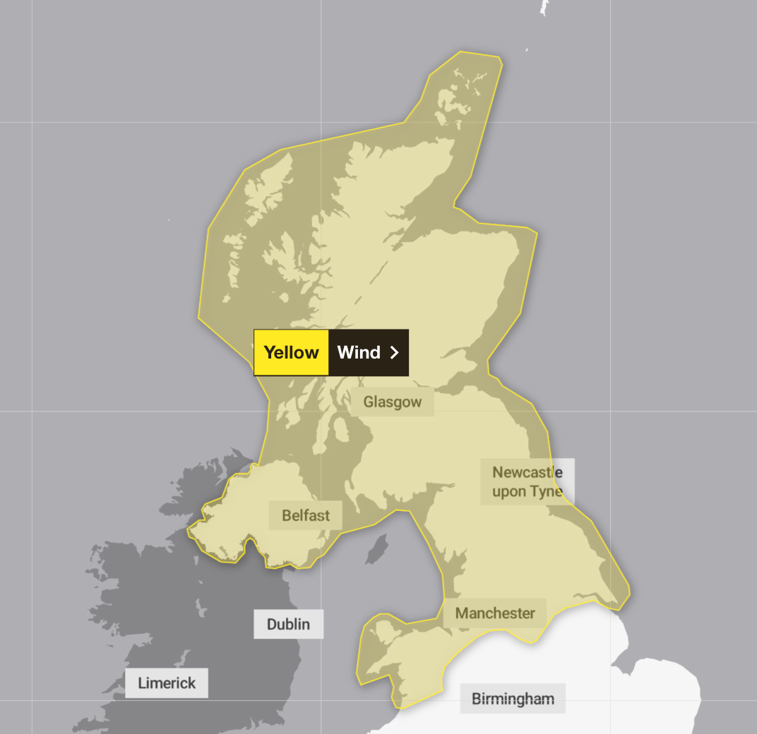
After a brief respite, a fresh alert is issued across the northern half of the UK as far south as Chester, Sheffield and Hull, including northern Wales, which will remain in place all the way through from 4pm on Tuesday until the last of the warnings finally abate at midday on Wednesday.
Storm Isha is the ninth named storm to hit the UK since the season began in September. Each storm is named when it poses a risk to people and they are given names beginning with consecutive letters of the alphabet.
The record number of named storms in one year is when the Met Office began the practice in 2015/16, with Storm Katie being the 11th and final storm of the season.
If there are three more named storms between next week and August, this year will mark a new record.
Cold Arctic air pushing south into North America is making the jet stream more active, the Met Office said, and because it flows from west to east, it is bringing stormier weather to the UK.
Additional reporting by PA
Join our commenting forum
Join thought-provoking conversations, follow other Independent readers and see their replies
Comments
Bookmark popover
Removed from bookmarks