Britain could see coldest January night in 14 years as more heavy snow on way
Conditions are expected to turn ‘stormy’ in coming days, say the Met Office
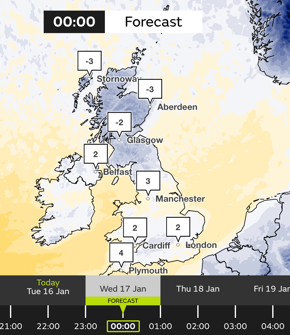
The coldest January temperatures in 14 years could hit the UK this evening the Met Office has reported, as temperatures could plummet to a chilling -15C overnight.
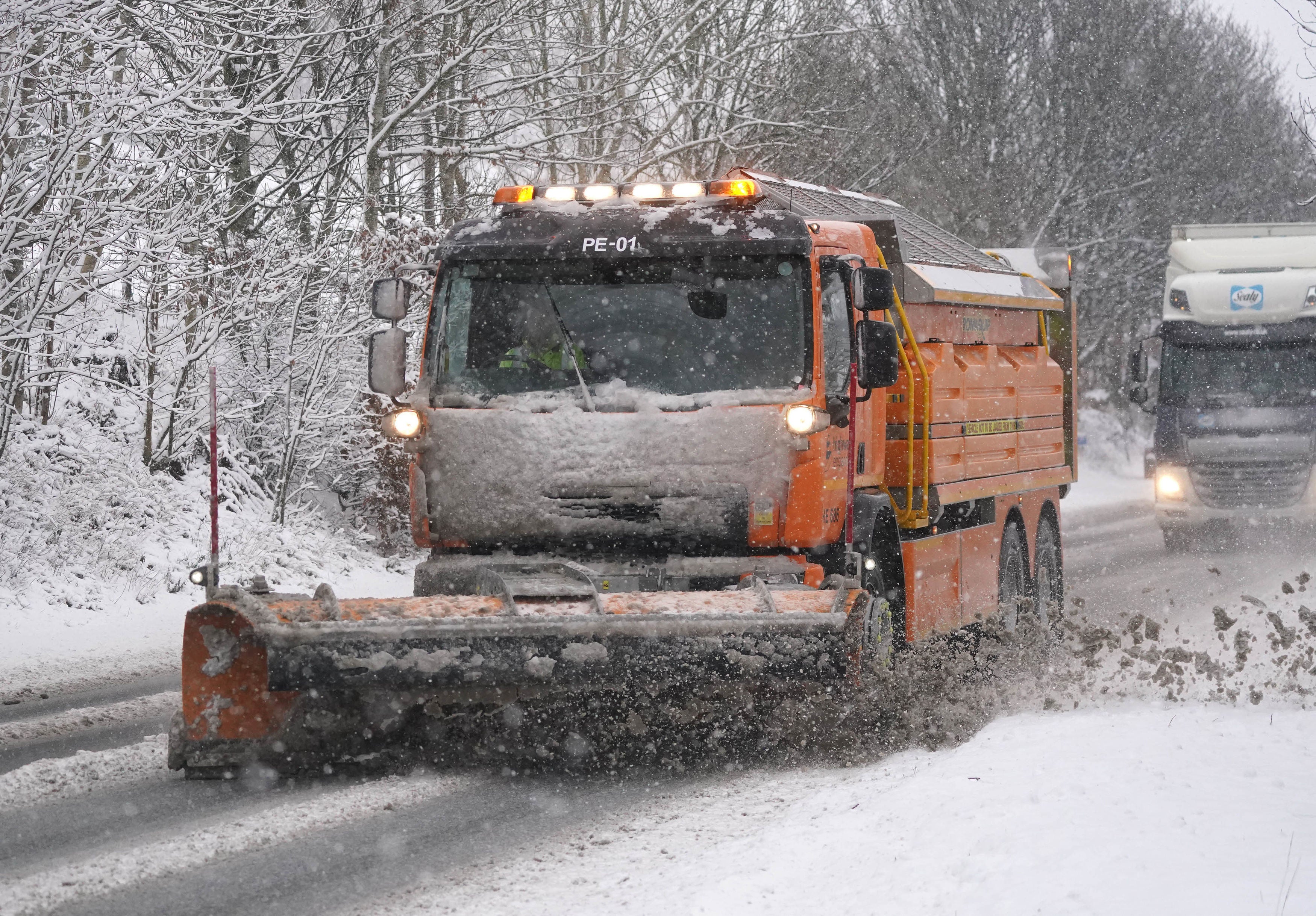
Yellow weather warnings for snow and ice continue to be in place across the country as the Met Office warned of travel delays, power cuts and injuries from the cold weather. The warnings are in place until Thursday.
Scotland, Northern Ireland and the north of England are expected to be the worst affected with other areas being affected throughout the week.
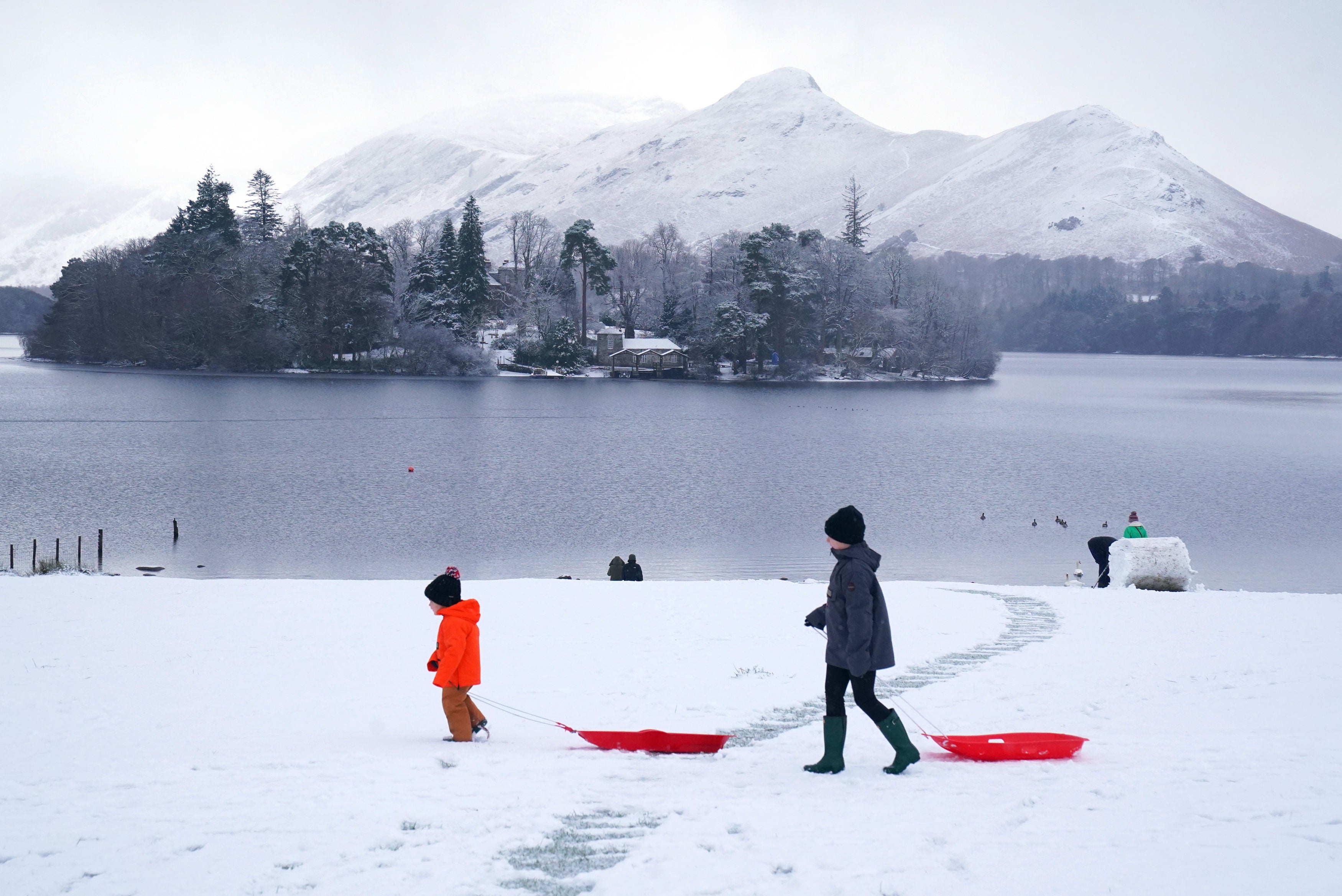
Snow-covered parts of Scotland could reach minus 15C on Tuesday night.
Freezing temperatures and snow will continue for much of Britain this week because of cold Arctic air before “potentially disruptive” stormy weather lands over the weekend.
The last time temperatures dropped this low was in January 2010, when minus 22.3C was recorded.
A Met Office spokeswoman said conditions would turn “stormy” in coming days.
She said the continuing low temperatures were due to the “prolonged nature” of the cold spell which is unusual for this type of weather, as they do not last more than three to five days in normal conditions.
“The air is coming directly from the Arctic, so it is exceptionally cold air,” she said.
“It’s staying cold until Friday, and then looking further ahead into the weekend we’ve got some deep areas of low pressure pushing in, so a big change in weather type, and we could see some stormy conditions by the end of the week.
“The cold isn’t lasting right to end of the week, but we have a very different type of potentially-disruptive weather arriving.”
The weather is forecast to turn stormy on Sunday, she added.
Over 120 schools were forced to close in Scotland on Tuesday as its justice secretary confirmed councils had nearly “500,000 tonnes of salt at their disposal” to deal with the thick snowfall.
The Met Office said that the country was currently in the grips of a “cold plunge of Arctic air” which has moved south across the whole country over the past few days, making it 5C to 6C lower than usual for this time of year.
Met Office forecaster Craig Snell predicted temperatures could plunge to as low as -15C in parts of the UK on Tuesday night, as he said people should “certainly” expect a very cold spell into Wednesday.
Police services dealt with multiple incidents across the UK on Tuesday morning after the RAC reported that the start of the week would be the busiest of the winter with 20 breakdown calls every minute.
The Roads Policing Unit of Merseyside Police said it had been dealing with “a number of incidents” on the roads on Tuesday morning as a result of the snow, while, Lancashire Road Police said its team has been responding to an “influx” of crashes across the county.
As the UK Health Security Agency issued an amber cold-health alert for the whole of England, emergency weather plans were enforced for homeless people across west Northamptonshire.
Its council enacted their Severe Weather Emergency Protocol (SWEP) with all known rough sleepers being provided somewhere warm and dry to stay overnight.
An amber alert means cold weather impacts are likely to be felt across the whole health service for an extended period of time, with potential for the whole population to be at risk.
The cold snap has also caused havoc for the National Hunt racing which was abandoned on Tuesday due to frozen ground. With parts of the track frozen and sub-zero temperatures forecast for the rest of the week, the course will need be inspected to ensure its safety before races over the weekend.
More than 40cm of snow could be seen on high ground in northwest Scotland by the end of Friday as it continues to build up over the coming days, the Met Office added.
Meanwhile, lower ground in northwest Scotland could see between five and 10cm of snow by the end of the working week.
And while unlikely, there is a chance of a few centimetres of snow falling on the extreme south of England this week.
The Met Office is reviewing the situation and any new warnings could be issued at short notice, it said.
Amy Fellows, national network manager at National Highways, said: “Freezing conditions bring so many hazards such as snow and ice, so take every possible step to understand your journey in advance and allow lots of extra time when travelling, to prepare for the unexpected.”
National Rail has warned the wintry weather could affect train journeys all week, with ScotRail saying services on the Highland Mainline route on Tuesday would be delayed by around 30 minutes.
Join our commenting forum
Join thought-provoking conversations, follow other Independent readers and see their replies
Comments
Bookmark popover
Removed from bookmarks