Met Office issues rare weather warning as thunderstorms continue
Travel disruption and flooding are likely
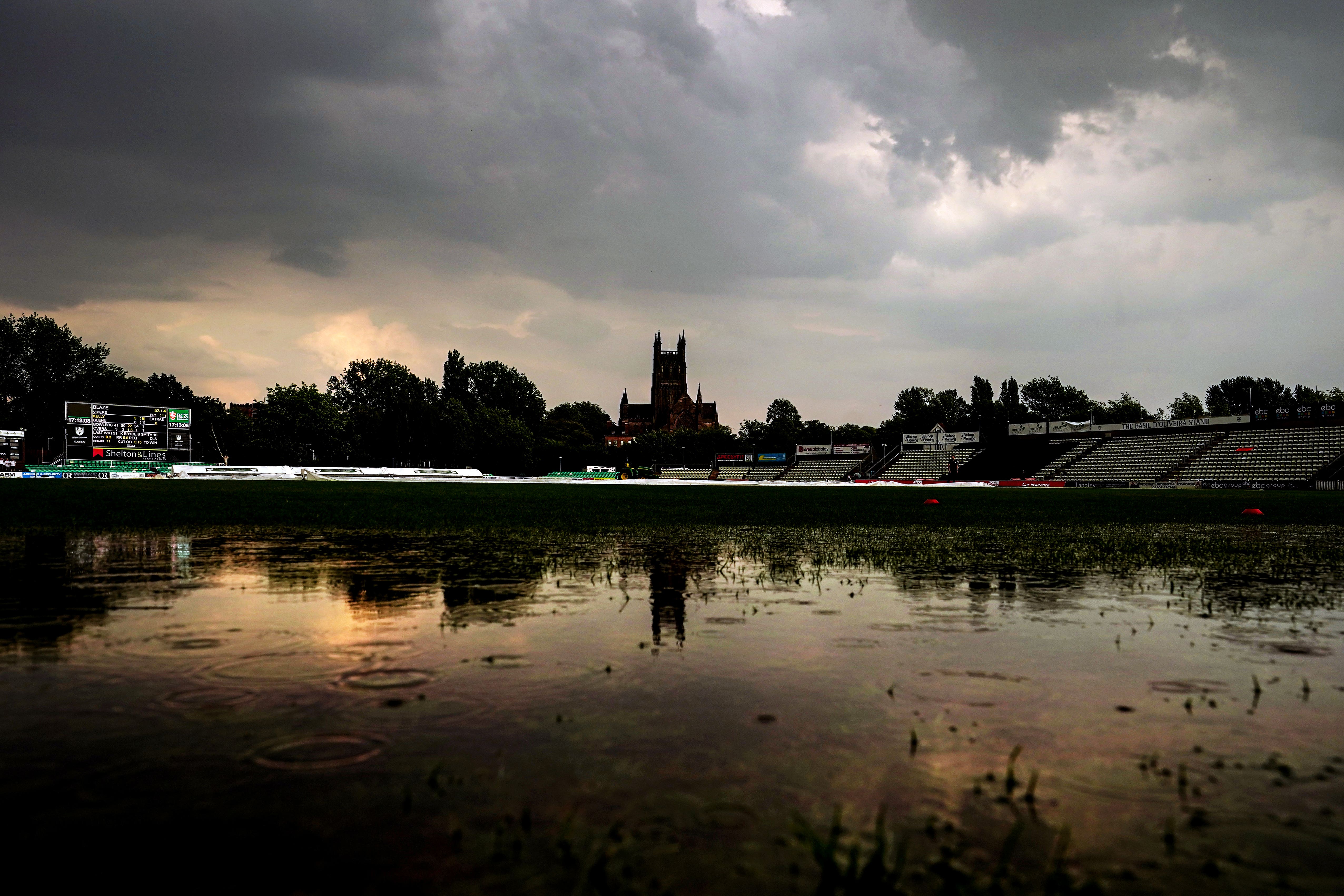
The Met Office has issued a rare amber weather warning as thunderstorms continue across parts of England.
Thunderstorms are expected to bring heavy rainfall, lightning, strong winds, and hail, according to the Met Office, with travel disruption and flooding likely.
The Met Office also warned flooding could cause power cuts in affected areas and warned some communities in the Midlands are likely to become temporarily cut off if roads flood.
Forecasters warned flooding could “happen quickly” and could cause damage to homes and businesses.
The amber warning applies to parts of the east and west Midlands, and the east, southeast and southwest of England.
The warning will last until 7pm on Monday.
Met Office meteorologist Alex Deakin said the Midlands, Wales and parts of northern England are most likely to see thunderstorms.
He added that parts of northern and western Scotland and Northern Ireland could also have “torrential downpours”.
Forecasters said: “A cluster or line of very active thunderstorms is moving towards the northwest from Bedfordshire and Buckinghamshire towards the West Midlands.


“These will bring a period of exceptionally heavy rainfall with 30-40mm falling in around 30 minutes, perhaps around 60mm in an hour for some locations.
“Frequent lightning strikes, winds that may gust to 45 mph, and some large hail stones perhaps up to 4cm in diameter will also accompany the storms.
“Surface water flooding may happen very quickly, likely disrupting travel and flooding some properties (especially in urban areas).
“Lightning, strong winds and hail will all pose a significant danger to those outdoors. The ultimate northwestern extent of this area remains somewhat uncertain.”
It comes as a yellow weather warning was issued for large parts of England including London, Oxford, Nottingham, and Manchester, with further alerts for Scotland and Northern Ireland, as thunderstorms hit the UK.
The Environment Agency also issued 14 flood alerts across the Midlands over concerns heavy, thundery showers could cause large amounts of surface water.
Temperatures hit highs of 32C on Sunday, the hottest day of the year so far.
Lightning strikes and torrential downpours are forecast for Monday after temperatures went above 30C over the weekend in parts of the UK for the first time since August 2022, the Met Office said.
Met Office Meteorologist Alex Deakin said while conditions are likely to be “dry and very warm and humid for the majority,” the heat and humidity are “likely to spark some big thunderstorms” across Wales, northern England, Northern Ireland and Scotland on Monday evening.
Meanwhile, it will become dry overnight with largely clear skies for most parts of the UK.
Join our commenting forum
Join thought-provoking conversations, follow other Independent readers and see their replies
Comments
Bookmark popover
Removed from bookmarks