Experts explain extreme weather as UK prepares for stormiest winter on record
There have been ten named storms already this year with over half of the season left to go
Weather experts have warned that the UK is likely facing its stormiest winter on record as the country has already faced ten named storms with over half of the season still to go.
The storm season begins each year in September and there are usually around six or seven storms in that year.
Since storm naming was introduced in 2015 the furthest through the list the group has got is to number 11, Storm Katie, which impacted the UK in March 2016.
This year’s storm naming season is now just one name away from matching 2015/16’s number of named storms, with over seven months still to go until the list is reset again.
Jim Dale, senior meteorological consultant at British Weather Services, warned the effects of these storms will only get worse alongside climate change.
“Without a shadow of a doubt there have been more storms than the average year and we haven’t even gotten to the end of winter yet,” he told The Independent.
When asked if this would be the stormiest year on record for the UK, he said: “Yes of course there is a chance of that happening. There’s time yet to break the record and there’s enough power in the barrel to take us in that direction.
“It’s always going to be a bit of a lottery but it is certainly possible.”
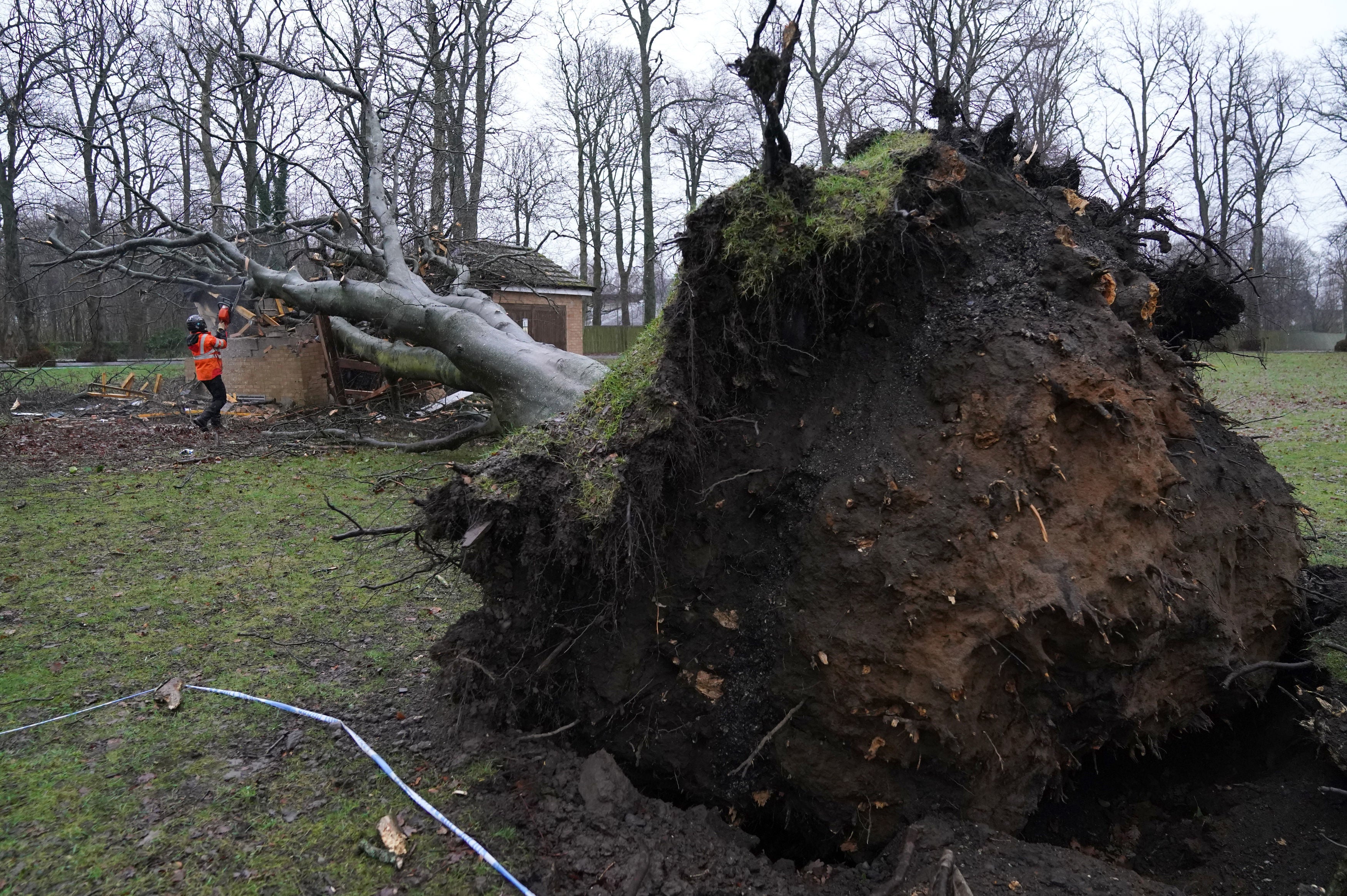
From Storm Agnes in September to Storm Jocelyn last week, the extreme weather has been wreaking havoc on the UK - flooding homes and businesses and even killing several.
The weather expert warned that the main issue comes as the storms will likely intensify as climate change worsens and bring stronger winds and more rain or snow.
“The expectation going forward is that we’ll see more intense storms and droughts,” he said. “Records are being beaten left right and centre and this will continue.”
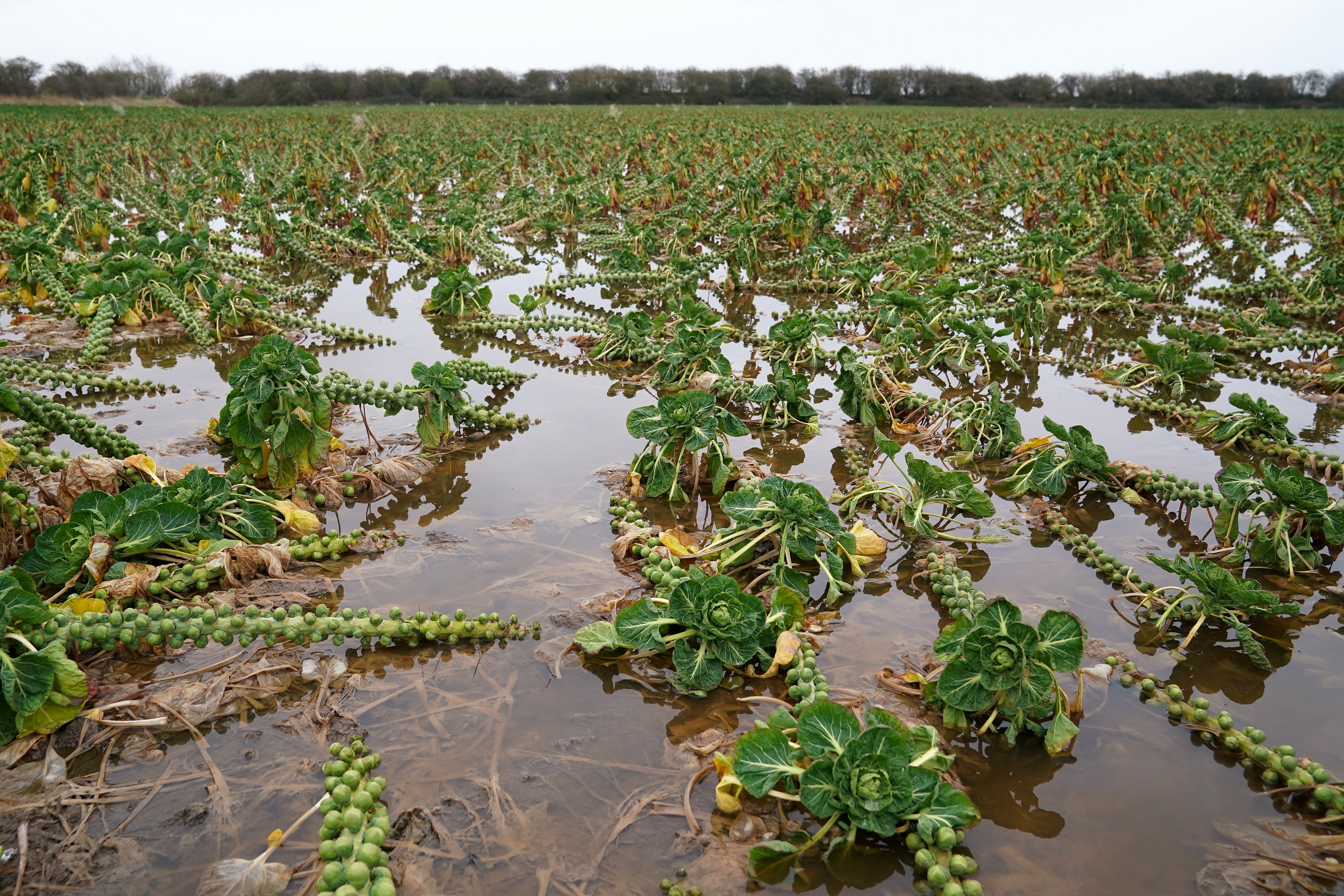
He added: “This will impact people as there will be more floods and drought. This will affect everyone including farmers who won’t have a job going forward because fields will be sodden or in drought. That’s the serious reality of it.
“For the wind, we often see trees land on cars and buildings and these things will get worse. Snow storms will also get worse as well.”
Mr Dale said the changes come as a direct result of energy being put into the atmosphere because of warmer global temperatures.
He likened the changes in storms to a pot of milk being heating on the stove over a long period of time at a low temperature.
He said: “If you put a pan of milk on the stove and put it on a very low heat it would slowly get warmer over time. What we’ve been doing is turning up the notch and now the milk has started to boil and is frothing over.”
He added: “The difference is, you can mop up spilled milk but you can’t mop up flooded areas.”
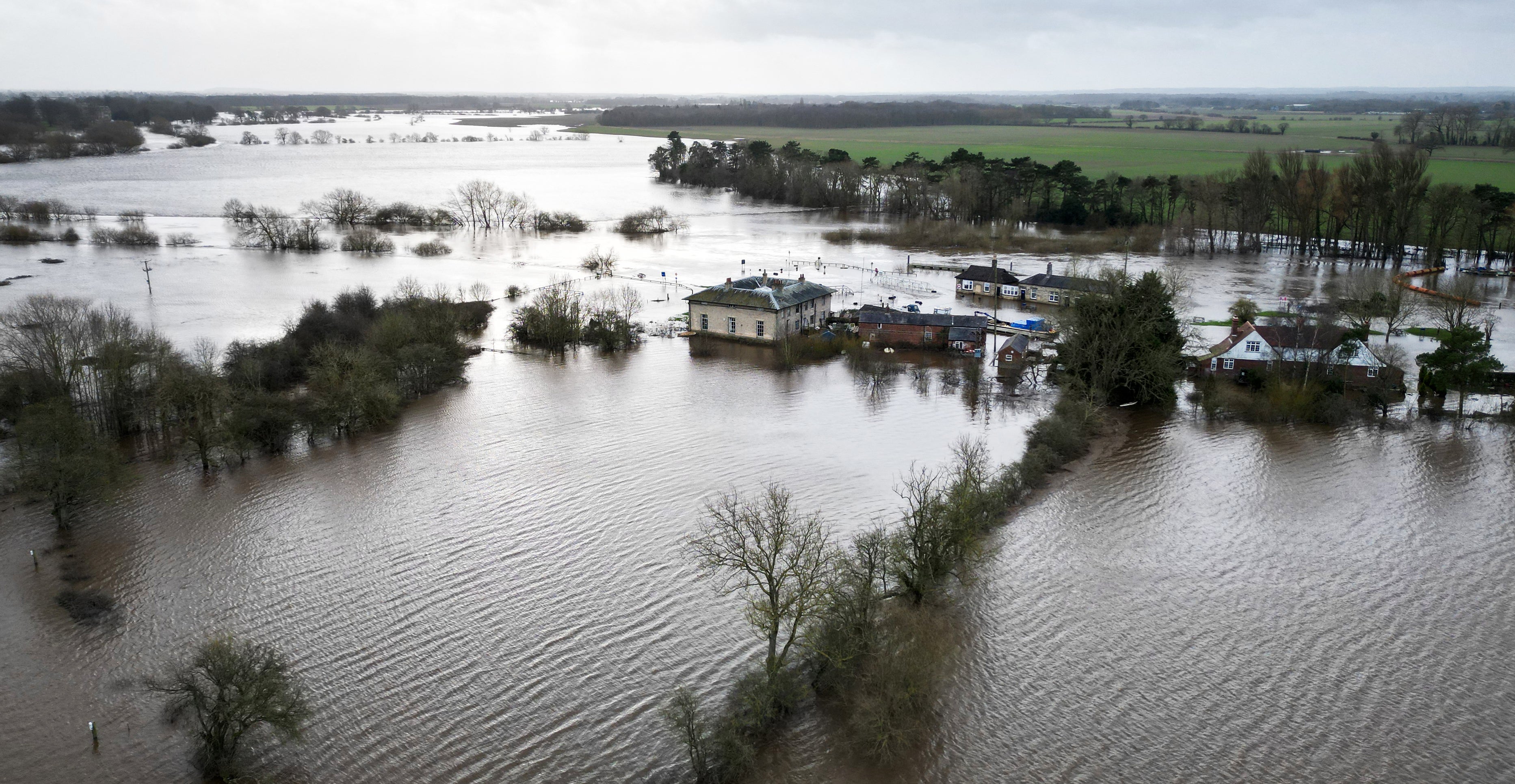
After Storm Jocelyn last week, the Met Office said the UK will continue to see spells of wet and windy weather, especially in northern and western areas. They said that while it’s too early to predict when the next named storm will be, there “remains a chance” of further impactful weather.
The forecasters said the particularly stormy season has been influenced by the jet stream.
Met Office Meteorologist and Presenter Annie Shuttleworth explained: “The jet stream greatly influences the weather we experience in the UK and during recent months this has largely been directed towards the UK and Ireland, helping to deepen low pressure systems.
“These systems have been directed towards the UK and have eventually become named storms due to the strong winds and heavy rain they bring.”
They added that a pool of very cold air has sunk southwards across North America and this temperature contrast has intensified the jet stream, influencing the development of Storm Isha and Storm Jocelyn.
Since 2015, a storm will be named in the UK when it has the potential to cause disruption or damage which could result in an amber or red warning. Storms will usually be named on the basis of the impacts from strong winds, but the impacts of other weather types such as flooding from rain, will also be considered.
Join our commenting forum
Join thought-provoking conversations, follow other Independent readers and see their replies
Comments
Bookmark popover
Removed from bookmarks