Storm Goretti map: Where Britain will be hit by heavy snow with yellow warnings in place
Storm Goretti is the first of 2026 and has caused travel delays
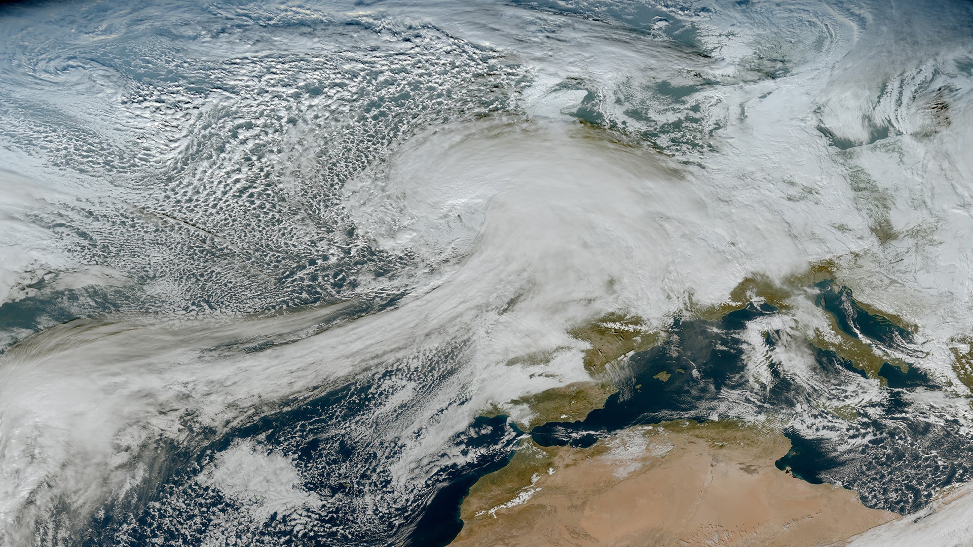
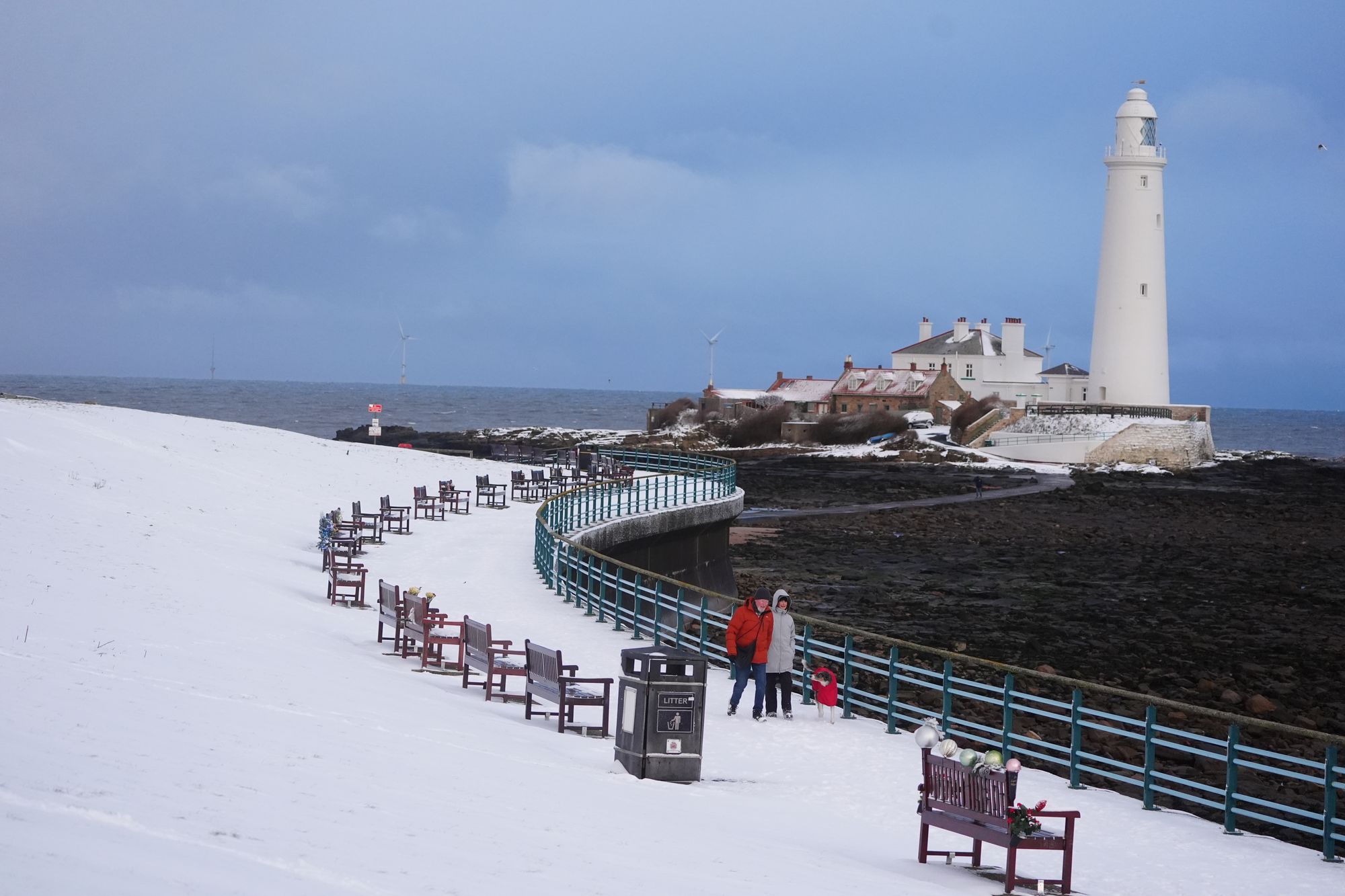
Storm Goretti has brought dangerous winds to the UK in addition to heavy snow, with gusts of up to 99mph recorded on Thursday.
The storm, named by French meteorological service Meteo-France, is the first of the year and has battered the UK with “violent” winds, causing significant travel disruption in parts of the country.
The UK Met Office put a red weather warning for wind in Cornwall and the Isles of Scilly in place on Thursday evening. The extreme weather knocked out power in around 60,000 homes across England and Wales, and caused Birmingham airport to shut one of its runways.
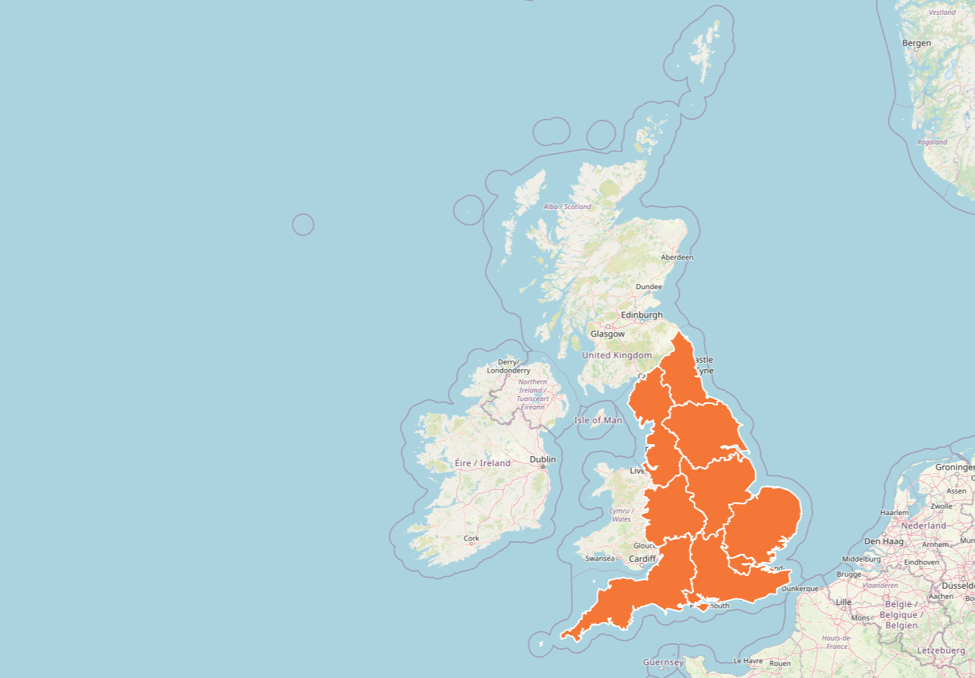
An amber warning for snow was issued for Thursday evening and remained in place until 9am on Friday, covering the Midlands, Yorkshire and parts of Wales. These regions continue to see heavy snow, which has seen schools close and travel severely disrupted.
Friday’s weather warnings
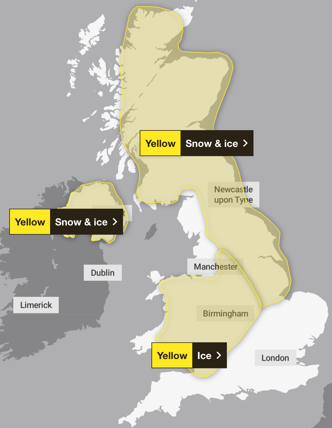
The amber “danger to life” warning for snow was in place in the Midlands, Wales and the South West until 9am, and has now lifted.
As of midday, only three weather warnings remain in place, which will all last until Saturday.
One warns of snow and ice covering much of Scotland, the North East, and the East Midlands, which came into effect at midday on Friday and will last until 3pm on Saturday.
Another is a warning for ice, covering most of the West Midlands and Wales, as well as parts of the North West and South West. This came into effect at midday Friday, and end at the same time on Saturday.
And while a yellow weather warning for ice covering all of Northern Ireland was set to end at 11am on Friday, a new warning has been issued for snow and ice has been issued lasting from that time until 11am on Saturday.
The previous snow and ice warning covering most of Scotland ended at midday, along with the yellow snow warning spanning the North, Midlands and Wales.
Meanwhile, the rain and wind warnings which covered Wales, the East of England, and much of the south coast have also all ended.
Saturday’s weather warnings
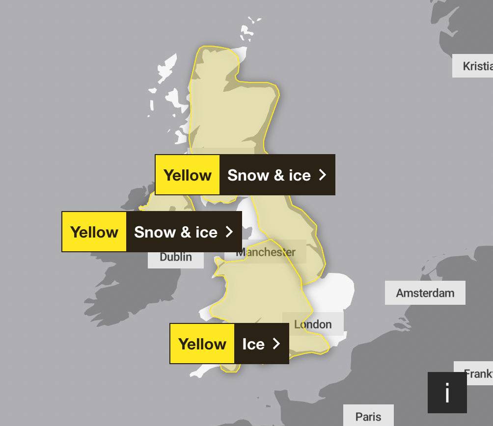
Three weather warnings will be in place on Saturday, all beginning on Friday and lasting overnight.
The warning for snow and ice in place covering Scotland, the North East, and the East Midlands will last until 3pm. The ice warning covering the West Midlands, parts of the South West and Wales will end at midday.
Meanwhile, the warning for snow and ice covering all of Northern Ireland will end at 11am.
Sunday weather warning
A yellow warning for ice and snow has been issued for Sunday, covering much of Scotland and North East England. Parts of the North West will also be affected.
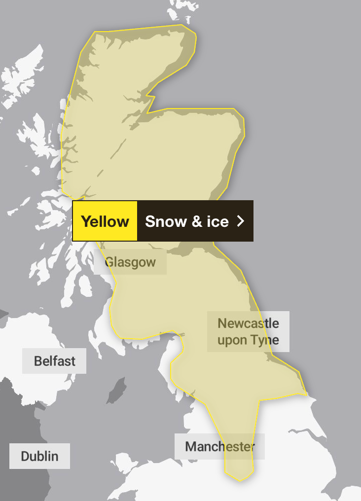
The warning will begin at 2am on Sunday, and last until 3pm. School closures and travel disruption in the affected areas can be expected.
Cold health alert extended until Sunday
The UK Health Security Agency (UKHSA) has issued amber cold health alerts for all of England until Monday at 12pm, warning there could be significant impacts across health and social care services, including a rise in deaths, particularly among those aged 65 and over or with health conditions.
Dr Agostinho Sousa, head of extreme events and health protection at UKHSA, said: “As the colder weather sets in, it is vital to check in on friends, family and neighbours that are most vulnerable.
“The forecast temperatures can have a serious impact on the health of some people, leading to increased risk of heart attacks, strokes and chest infections, particularly for individuals over the age of 65 and those with pre-existing health conditions.”
Chief forecaster Neil Armstrong said: “Storm Goretti will be a multi-hazard event, with the most significant impacts from snow in parts of Wales and the Midlands, though rain and strong winds also have the potential to bring disruption to many.
“Goretti will bring snow on its northern edge, this most likely over Wales and the Midlands. Here, accumulations of 5 to 10cm are likely widely, with 15 to 25cm in some places, especially hills, and perhaps up to 30cm very locally.”
Travel disruption
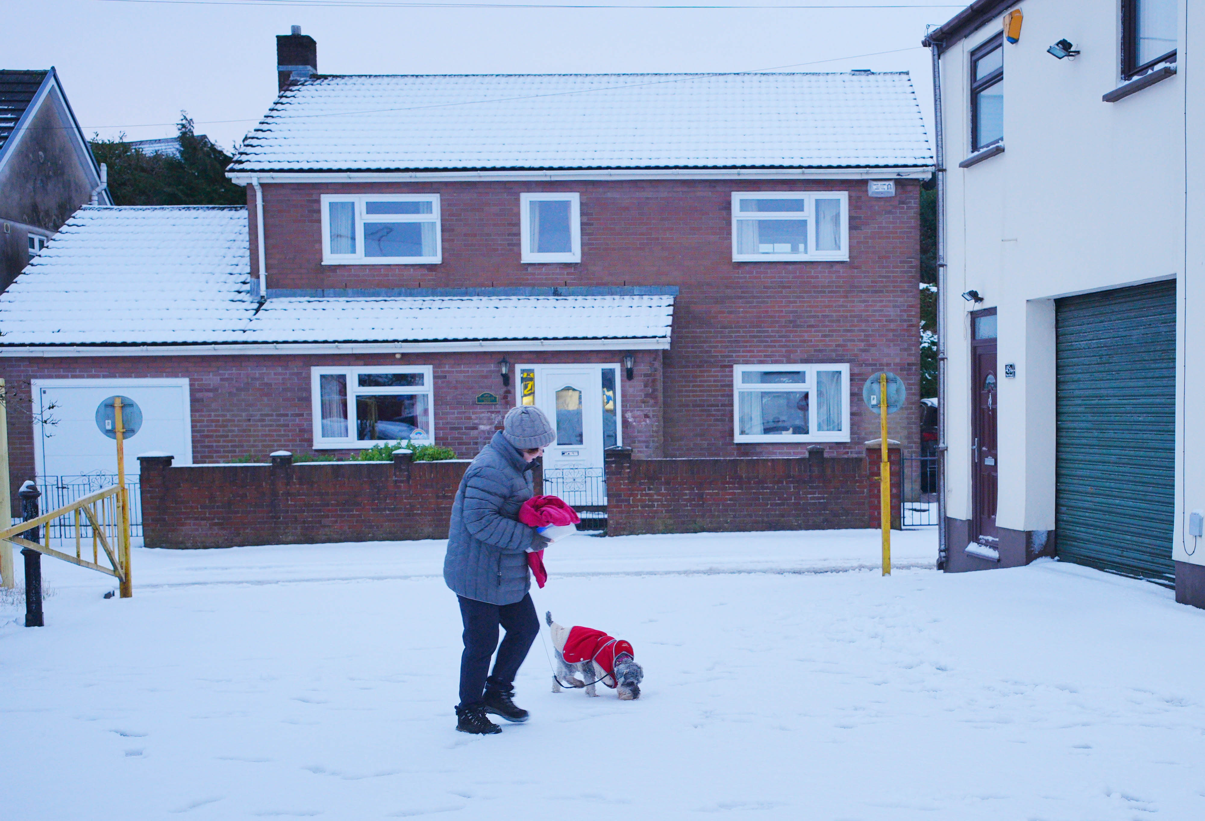
Hundreds of schools across the UK will remain closed as much of the country braces itself for further snow and icy conditions. Some rural areas have been completely cut off, and transport is severely affected by the weather.
Rail passengers should also expect a series of line closures during the cold period.
Avanti West Coast said “do not travel” advice is in place on its Midlands routes until 1pm on Friday.
East Midlands Railway (EMR) said the Hope Valley line between Sheffield and Manchester will be closed all day.
A number of other lines, including between Nottingham and Lincoln and between Leicester and Nottingham, will be closed until after 10am on Friday.
The train operator said: “Please check your journey before travelling today. Heavy snowfall has impacted our regional routes with some services starting later than usual.”
Transport for Wales said it will not run services on the majority of its routes on Friday.
Chiltern Railways also said it plans to operate around half of its normal timetable. It is not running services north of Birmingham Moor Street or on the line to Stratford-upon-Avon.
The statement added: “Customers should check before they travel today, as services may be subject to disruption due to the impact of Storm Goretti. Services may be further amended at short notice.”
Thousands of passengers booked to fly to or from Birmingham airport are out of position this morning. But the runway is now open after 10 hours of closure, which saw dozens of cancellations and diversions.
Officials in the West Midlands have warned of the “worst snowfall in a decade” as parts of England and Wales prepare to be hit with 5 to 10cm of snow on Friday, and up to 15 to 25cm in some areas.


Join our commenting forum
Join thought-provoking conversations, follow other Independent readers and see their replies
Comments
Bookmark popover
Removed from bookmarks