Storm Babet map reveals when and where heavy rain will hit UK
As much as 200mm of rain is expected to fall on central and eastern areas of Scotland and there is a possibility of 70mph gale-force winds affecting northern parts of the UK

The UK faces torrential rain and powerful winds in the second named storm of the season later this week.
Storm Babet will bring “impactful” weather to the UK from Wednesday, the Met Office has said as it issued a four-day warning for most of the country.
Yellow severe weather warnings cover much of Scotland, eastern Northern Ireland, the northeast of England, Yorkshire, the East Midlands and East Anglia.
As much as 150mm to 200mm of rain is expected to fall on central and eastern areas of Scotland and there is a possibility of 70mph gale-force winds affecting northern parts of the UK, forecasters warned.
Deputy chief meteorologist Steven Keates said Storm Babet will bring “impactful rain” to the UK, especially in eastern Scotland, Northern Ireland and northern England later this week.
“Heavy and persistent rain will fall onto already saturated ground bringing a risk of flooding,” he added. “As well as heavy rain, storm Babet will bring some very strong winds and large waves near some eastern coasts too. Gusts in excess of 60mph are possible in eastern and northern Scotland from Thursday.”
The first Yellow weather warning for rain is set to come into place over Northern Ireland at 6am on Wednesday, followed by a further warning being implemented across the East Midlands to southern Scotland.
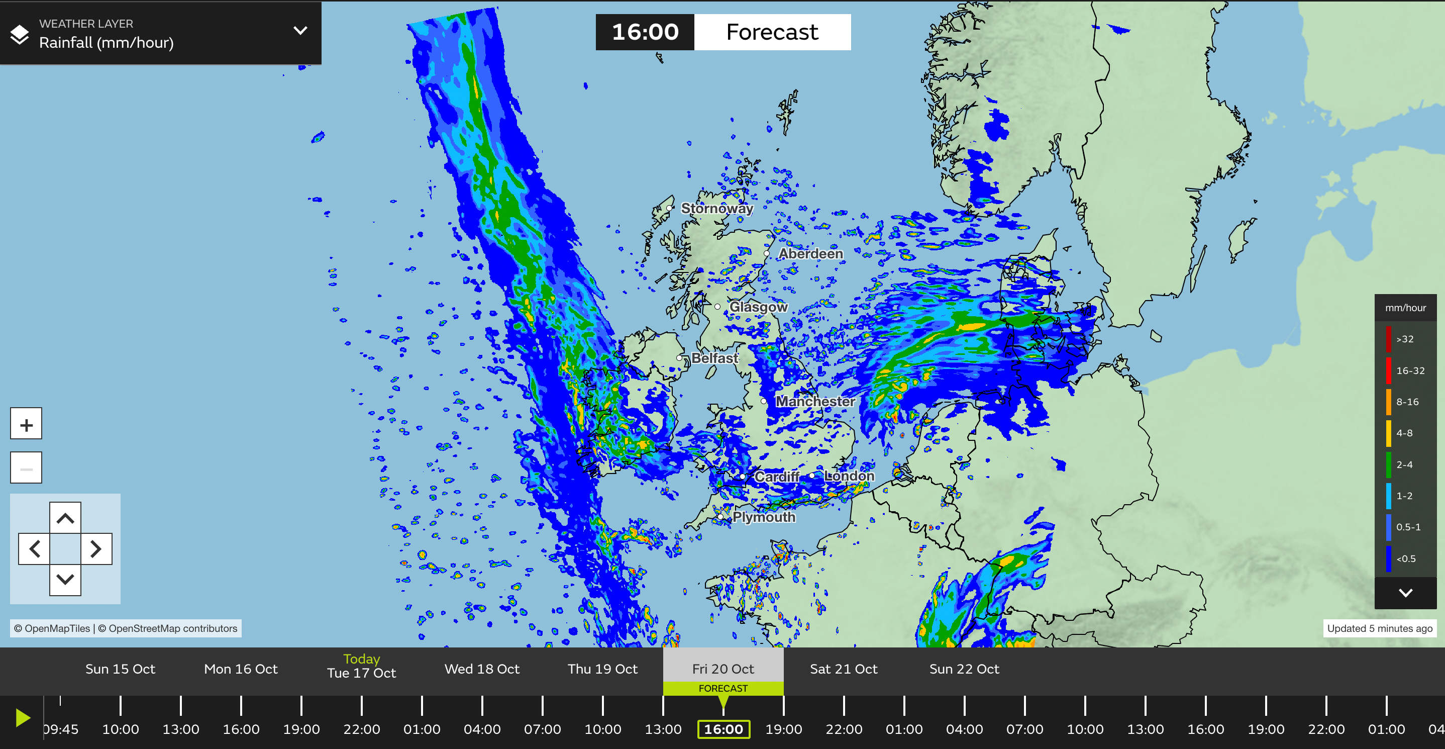
Below we can see Storm Babet’s path as it sweeps across the UK:
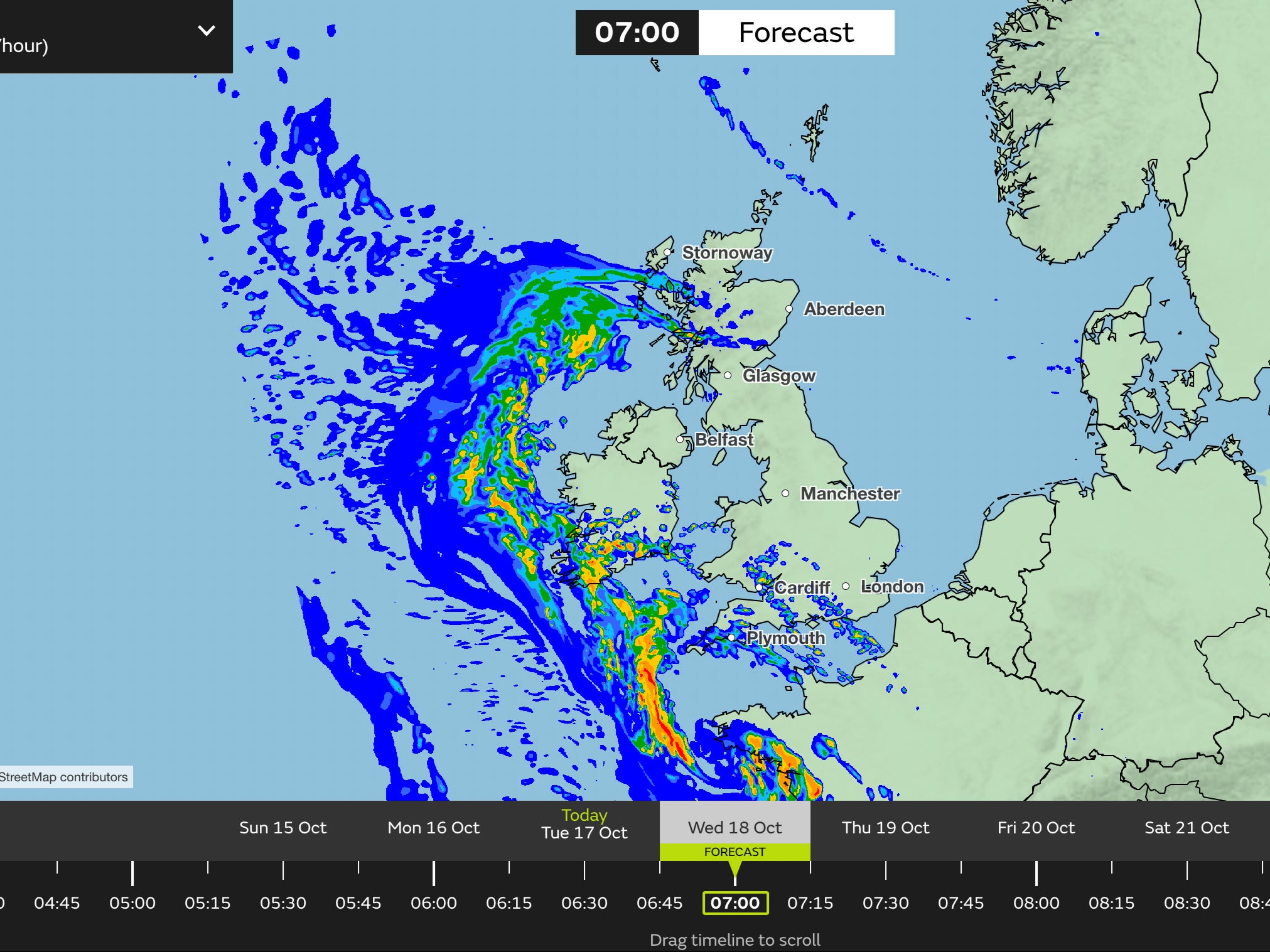
On Wednesday morning we see the Storm begin to cross over Britain, where it will stay until the weekend.
By 6am, a yellow weather warning for rain will be implemented in parts Northern Ireland, which will see a chance of flooding to homes and dangerous driving conditions.
The Met Office added that there is a small chance communities could be “completely cut off, perhaps for several days”.
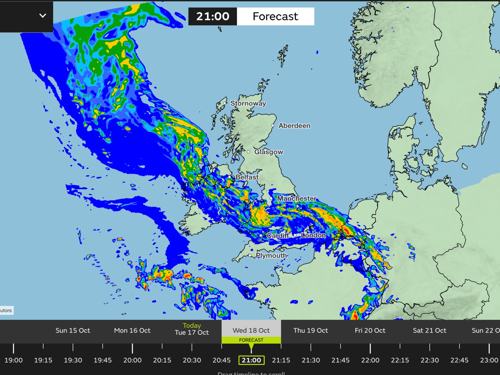
By 9pm on Wednesday, Storm Babet will cross into the mainland, triggering a yellow rain warning in eastern England, southern Scotland and the Pennines.
This warning is set to stay in place until Saturday morning and will bring the possibility of power cuts and train cancellations to the region.
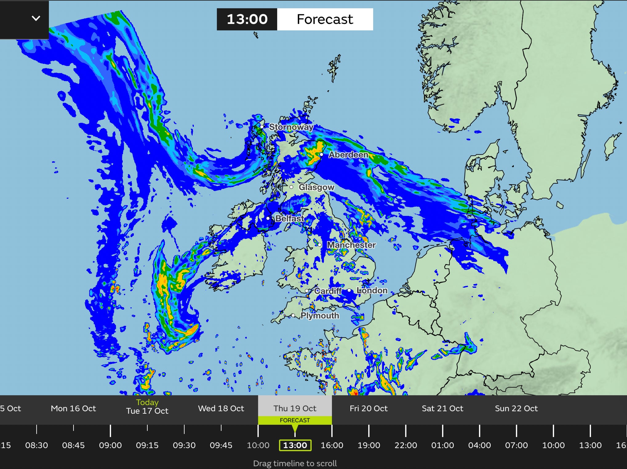
On Thursday, the UK will see the full force of Storm Babet, with five yellow weather warnings for rain and wind being in place.
In addition to those already under a yellow rain warning, additional areas affected include central and northern Scotland which will experience “very strong southeasterly winds” according to the Met Office.
Central and eastern Scotland has also been issued a yellow weather warning for rain, which the Met Office say could possibly be a “danger to life”.
Northern Ireland’s yellow weather warning for rain will clear by 10am on Thursday, but rain is expected to continue in the region.
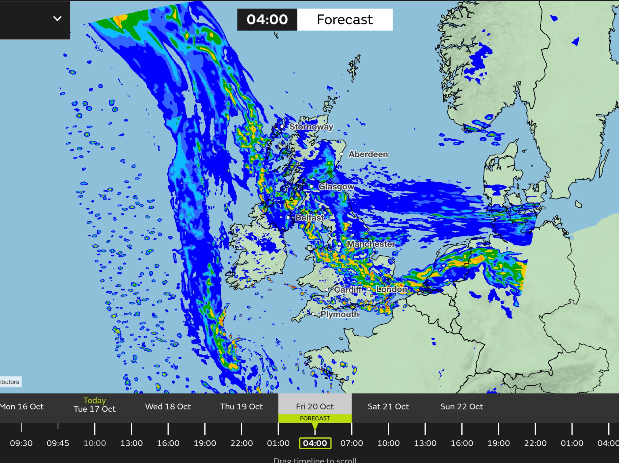
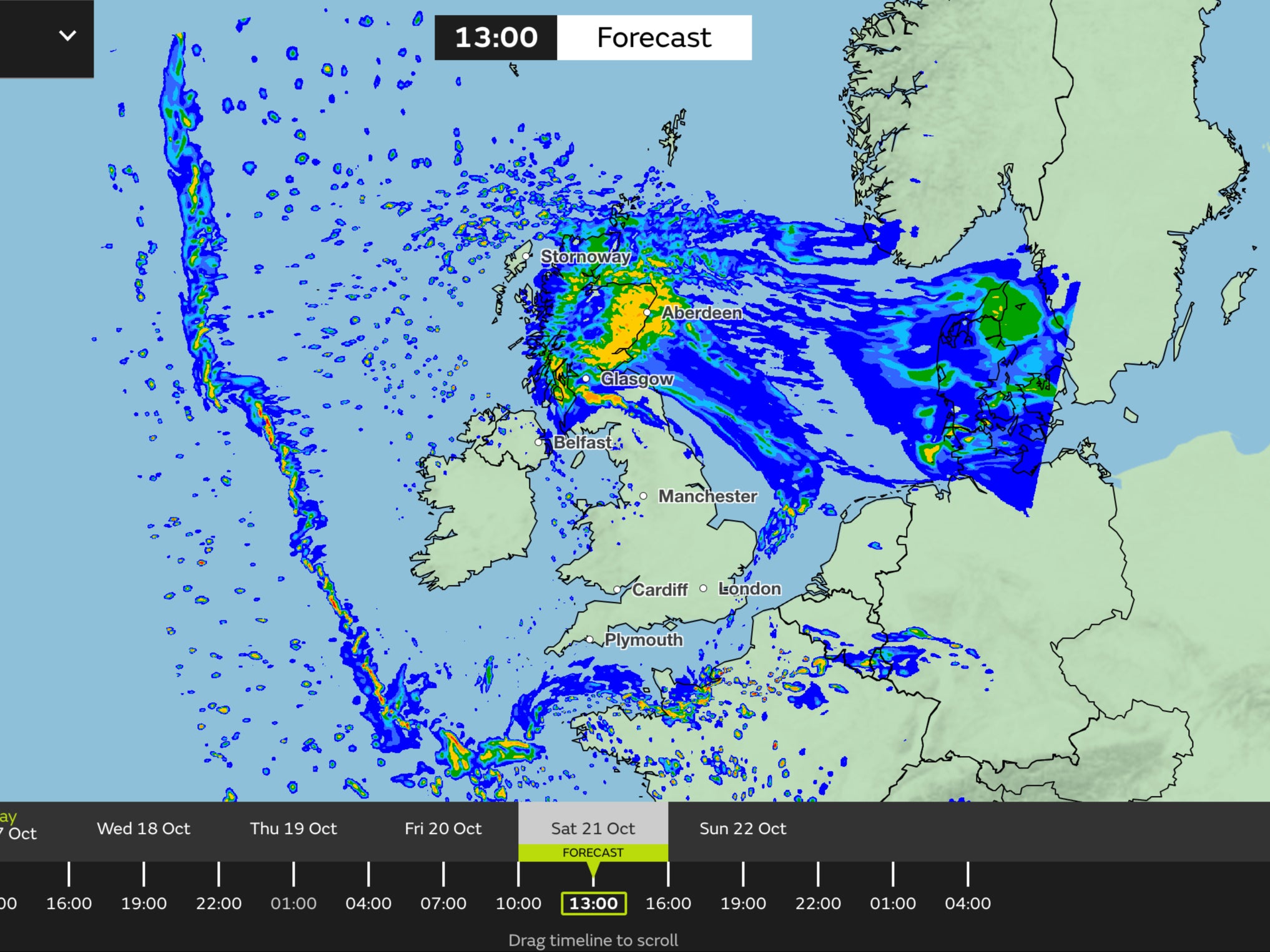
By early morning on Friday, heavy rain is expected to continue to fall across eastern England and southern and central Scotland.
Wind speeds are forecasted to reach 40mph in northern Scotland at this time as Storm Babet continues to move across to the northeast.
By midday on Friday, the yellow wind warning for northern Scotland is expected to clear, but one yellow rain warning remains in eastern Scotland until the following day.
Scotland typically receives 168mm of rainfall in October, but the country will receive more than this in the span of a few days.
David Morgan, flood duty manager for the Scottish Environment Protection Agency (SEPA), said: “Storm Babet will bring heavy rain and high winds across Scotland from Wednesday evening, starting in the southwest before moving across to the northeast through Thursday and into the weekend.
At 6am on Saturday, the yellow weather for rain in place across eastern England and southern Scotland is expected to clear.
The final UK yellow weather warning for rain in central and eastern Scotland in place is due to clear by midday.
While the Met Office’s forecast still predicts rainfall in northern Scotland by the early afternoon, the worst of the weather is expected to have cleared the northeast.
As Storm Babet makes its way over to the UK, the Met Office advises to stay up to date with flood warnings from your local flood warning agency as well as local authorities.
They added that weather warnings will “likely” be updated throughout the week.
Join our commenting forum
Join thought-provoking conversations, follow other Independent readers and see their replies
Comments
Bookmark popover
Removed from bookmarks