UK weather – live: Yellow weather warning issued as Met Office forecast return of snow
Cold snap predicted for week ahead as February takes a chilly turn
The Met Office has issued a fresh weather warning over the weekend as the UK braces for another spell of snow next week.
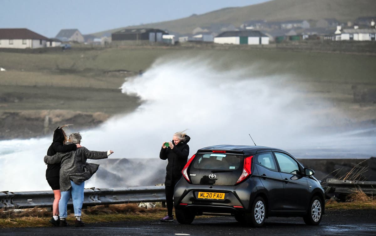
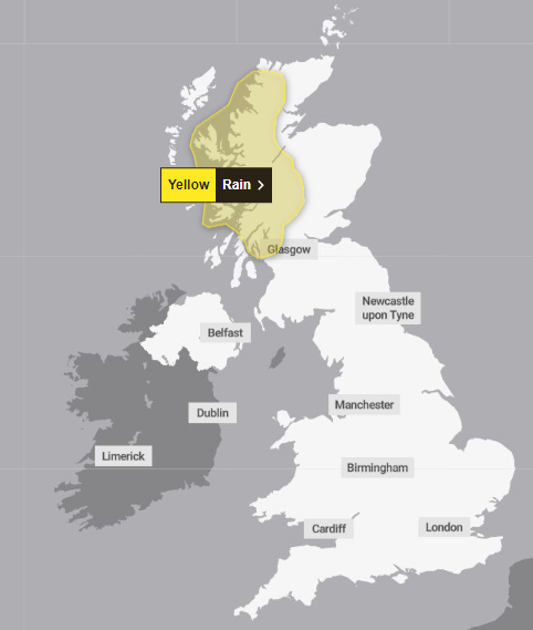
The yellow weather warning for rain is expected to affect areas in western Scotland from Sunday at 6pm until 9pm on Monday - bringing travel disruption, power cuts and flooding.
It comes as experts warned that snow will fall in Scotland and even potentially down south as cold air dubbed the “Troll from Trondheim” makes its way over the country from Norway.
Jim Dale, Senior Meteorological Consultant at British Weather Services told The Independent: “We haven’t got to end of winter yet and next week will be colder. There will be snow in Scotland and the north and potentially in the south.”
In its long-range forecast, the Met Office has also said there will be some hill snow over the weekend and that “there is a chance colder conditions could start to feature” in the second week of February.
Experts explain extreme weather as UK prepares for stormiest winter on record
Weather experts have warned that the UK is likely facing its stormiest winter on record as the country has already faced ten named storms with over half of the season still to go.
The storm season begins each year in September and there are usually around six or seven storms in that year.
Since storm naming was introduced in 2015 the furthest through the list the group has got is to number 11, Storm Katie, which impacted the UK in March 2016.
This year’s storm naming season is now just one name away from matching 2015/16’s number of named storms, with over seven months still to go until the list is reset again.
Experts explain extreme weather as UK prepares for stormiest winter on record
This evening’s forecast
The south of England and Wales will be sunny with patchy light rain, predict the Met Office.
Elsehwerewill be clearer with showers in the north and northwest.
Northern Ireland and western Scotland will experience heavier downpours and wind.
Tomorrow’s weather forecast
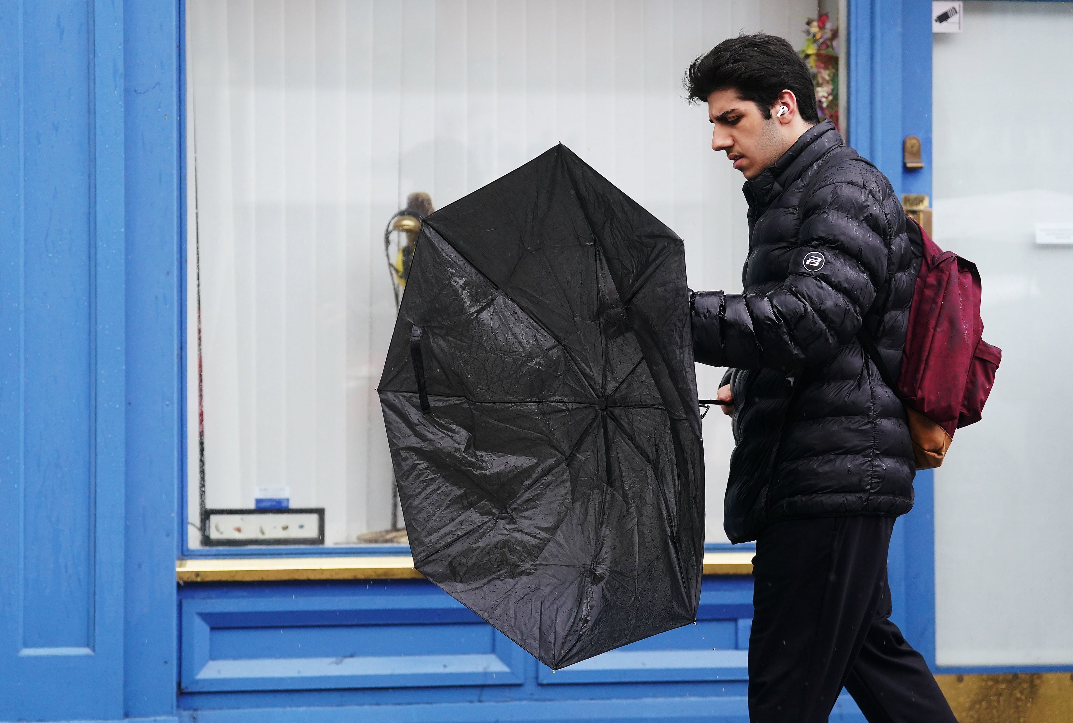
Heavy rain is set to hit western Scotland with lighter rain across Northern Ireland, northern England and the Welsh hills.
The southeast will be drier and cloudier and the northeast of Scotland will experience brighter conditions- with showers.
The whole country is set to be windy and mild.
Mapped - Sunday’s rain warning
There is a chance communities could become cut off in western Scotland tomorrow as heavy rain is set to fall.
The Met Office has issued a warning tomorrow from 6pm tomorrow until 9pm Monday.
Experts explain extreme weather as UK prepares for stormiest winter on record
Weather experts have warned that the UK is likely facing its stormiest winter on record as the country has already faced ten named storms with over half of the season still to go.
The storm season begins each year in September and there are usually around six or seven storms in that year.
Since storm naming was introduced in 2015 the furthest through the list the group has got is to number 11, Storm Katie, which impacted the UK in March 2016.
This year’s storm naming season is now just one name away from matching 2015/16’s number of named storms, with over seven months still to go until the list is reset again.
Experts explain extreme weather as UK prepares for stormiest winter on record
Watch - Waves crash over runway at Shetland’s Sumburgh airport as storm batters UK with 85mph winds
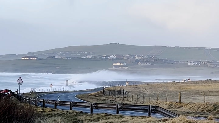
Waves crash over runway at Shetland airport as storm batters UK with 85mph winds
Will the UK see more extreme weather conditions?
From Storm Agnes in September to Storm Jocelyn last week, the extreme weather has been wreaking havoc on the UK - flooding homes and businesses and even killing several.
The weather expert warned that the main issue comes as the storms will likely intensify as climate change worsens and bring stronger winds and more rain or snow.
“The expectation going forward is that we’ll see more intense storms and droughts,” he said. “Records are being beaten left right and centre and this will continue.”
He added: “This will impact people as there will be more floods and drought. This will affect everyone including farmers who won’t have a job going forward because fields will be sodden or in drought. That’s the serious reality of it.”
Why is the UK seeing more extreme weather conditions?
Mr Dale said the changes come as a direct result of energy being put into the atmosphere because of warmer global temperatures.
He likened the changes in storms to a pot of milk being heating on the stove over a long period of time at a low temperature.
He said: “If you put a pan of milk on the stove and put it on a very low heat it would slowly get warmer over time. What we’ve been doing is turning up the notch and now the milk has started to boil and is frothing over.”
He added: “The difference is, you can mop up spilled milk but you can’t mop up flooded areas.”

Experts explain extreme weather as UK prepares for stormiest winter on record
Weather experts have warned that the UK is likely facing its stormiest winter on record as the country has already faced ten named storms with over half of the season still to go.
The storm season begins each year in September and there are usually around six or seven storms in that year.
Since storm naming was introduced in 2015 the furthest through the list the group has got is to number 11, Storm Katie, which impacted the UK in March 2016.
This year’s storm naming season is now just one name away from matching 2015/16’s number of named storms, with over seven months still to go until the list is reset again.
Experts explain extreme weather as UK prepares for stormiest winter on record
Mapped - Today’s rain warning
There is a chance communities could become cut off in western Scotland tomorrow as heavy rain is set to fall.
The Met Office has issued a warning from 6pm tomorrow until 9pm Monday.

Join our commenting forum
Join thought-provoking conversations, follow other Independent readers and see their replies
Comments